;)
;)
;)
The Sea Level Rise app: crowdsourcing of information
Posted by Matt Rajkowski on June 26, 2014, 3:45 PM EDT
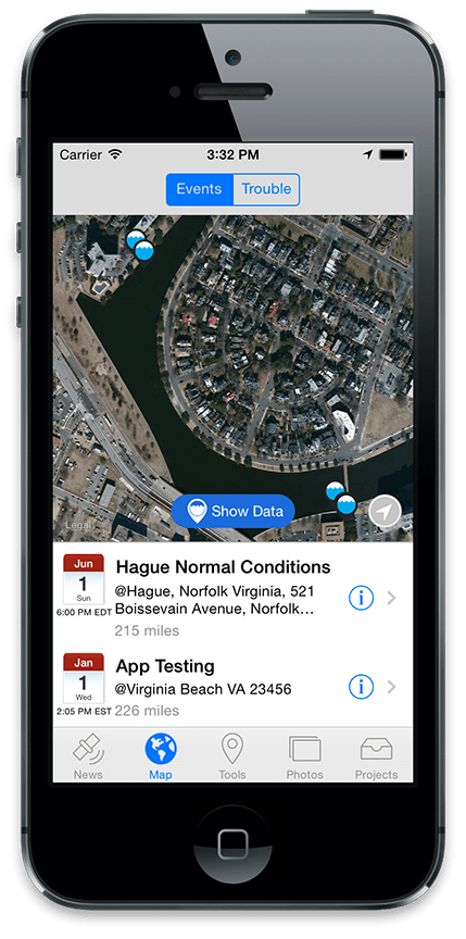
Concursive has worked with Wetlands Watch of Norfolk, Virginia to bring a new app to Apple's App Store called Sea Level Rise. The premise of the app is to record sea-level data in Hampton Roads, Virginia around certain events (like tides and rainfall) and visualize the points on a map. The data will be used for various analysis and alerts over time.
To accomplish data capture, the Sea Level Rise app has a 'Tools' tab which combines several of Concursive's ConcourseConnect platform features to allow participants to capture data.
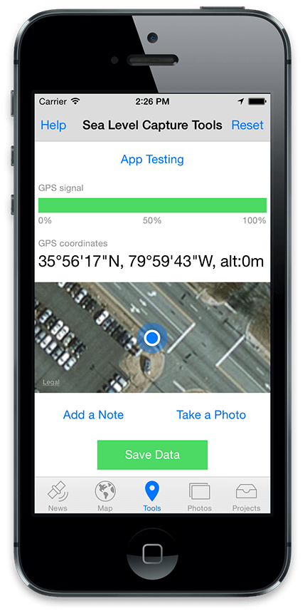
The goal is to accurately capture a user's location with some user provided details and store it around the context of a profile, in this case a sea-level rise event. Volunteer users can add notes and photos which get stored along with the app's coordinates (latitude, longitude, altitude, and GPS accuracy).
Starting with a typical top-level 'Event' profile in Connect, users can perform multiple 'check-ins' into this Event profile on their device. The user sees their location on the map where they are checking in, and the user has an option of adding a note and photo along with their coordinates.
Since accuracy is important, the GPS signal level is displayed. From experience with testing the coordinates, iPhones have been just as accurate as a dedicated Garmin GPS made for the outdoors – with nearly identical results. While the GPS is nearly spot-on (reporting within 5 meters of accuracy), the Apple and Google maps do have some offset when the coordinates are plugged into the maps so the assumption is that the coordinates are correct but the mapping imagery is offset a little, or vice-versa. Regardless, the points have been very helpful as they can be captured very quickly.
Sea Level Rise uses the ConcourseConnect mobile platform and backend. Contact Concursive for more information about the platform.